
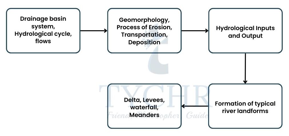
1. DRAINAGE BASIN HYDROLOGY AND GEOMORPHOLOGY
Approaching the topic:
- Topics covered in the chapter:
- Defining concepts
- Differentiating certain concepts
1.1. Defining the Chapter:
1.1.1. Drainage: It is the process of either naturally or artificially removing water from a surface and subsurface from an area that has too much water.
1.1.2. Basin: It is an area drained by a river and all of its tributaries.
1.1.3. Hydrological Cycle: It is the scientific study of the movement, distribution and management of water on Earth and other planets, including the water cycle, water resources and environmental watershed sustainability. Geomorphology:the study of how the earth’s surface’s physical features relate to its geological structures. Geomorphologists use a combination of field observations, physical experiments, and numerical modelling to try to figure out why landscapes look the way they do, understand the history and dynamics of landforms, and predict changes.
1.1.4. Geomorphologists are experts in a variety of fields, including geotechnical engineering, geology, archaeology, climatology, and physical engineering. Numerous research styles and interests in the field are influenced by this diverse range of interests.
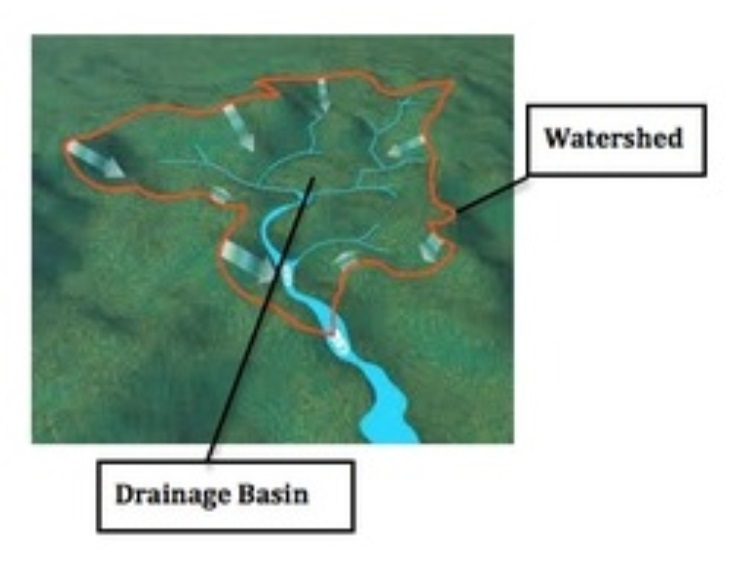
1.2. Drainage basin:
A drainage basin is any area of land where precipitation accumulates and flows into a common outlet, like a river, bay, or other body of water
1.3. Watershed: An area or ridge of land that separates waters flowing to different rivers, basins, or seas.
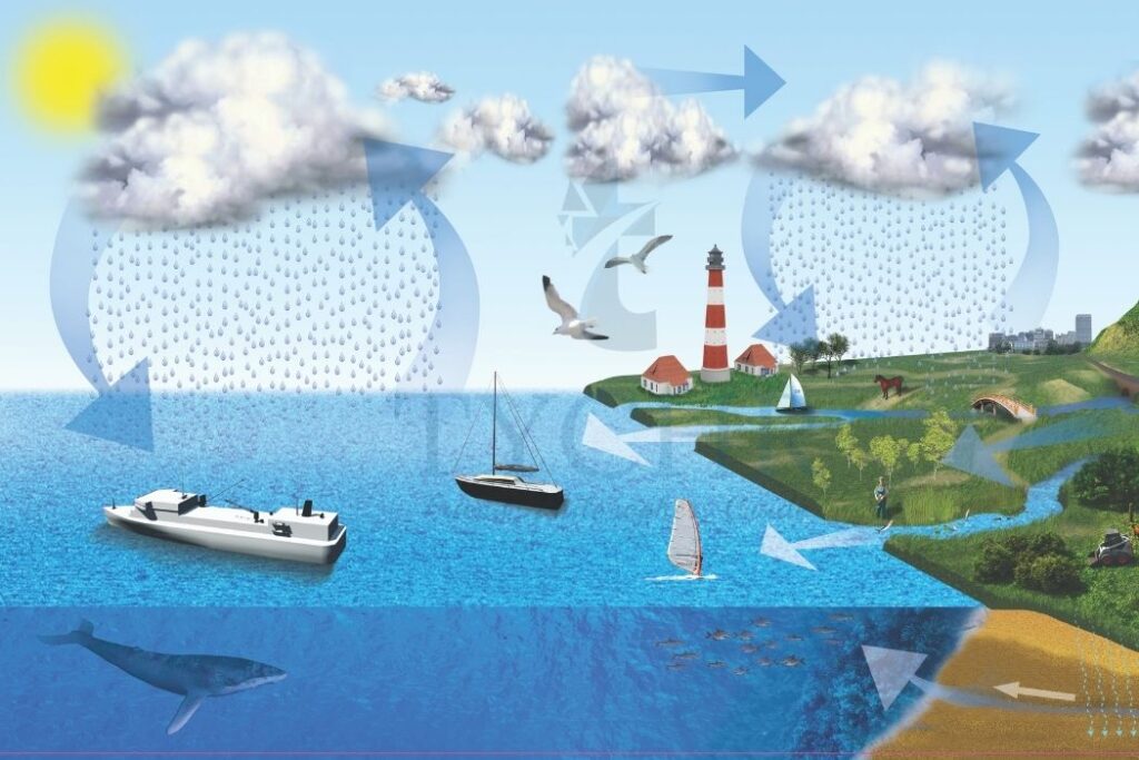
1.4. Hydrological cycle:
The Hydrologic Cycle (also called the Water Cycle) is the continuous movement of water in the air, on the surface of and below the Earth. This cycle is the exchange of energy which influences climate. When water condenses, it releases energy and warms the environment. When water evaporates, it takes energy from the surrounding environment and temperatures drop.
1.5. Inputs:
1.5.1. Precipitation: The conversion and transfer of moisture in the atmosphere in all forms like:
- Rainfall
- Dew
- Frost
- Snow
1.6. Outputs:
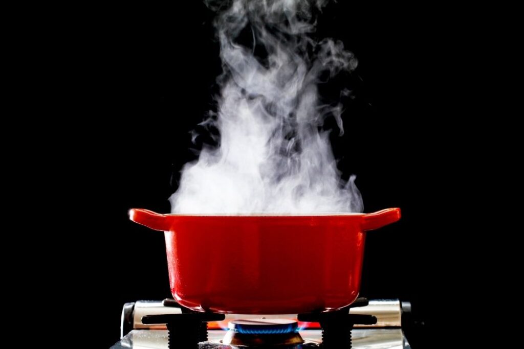
1.6.1. Evaporation: It is a process through which liquid or a solid changes into gaseous form. It is the conversion of the solid or liquid snow, ice, water to water vapour in the atmosphere.
1.6.2. Evapotranspiration: It is “evaporation + transpiration”. Transpiration is the process by which the water vapours are escaped from the living plant’s leaves and it then enters into the atmosphere.
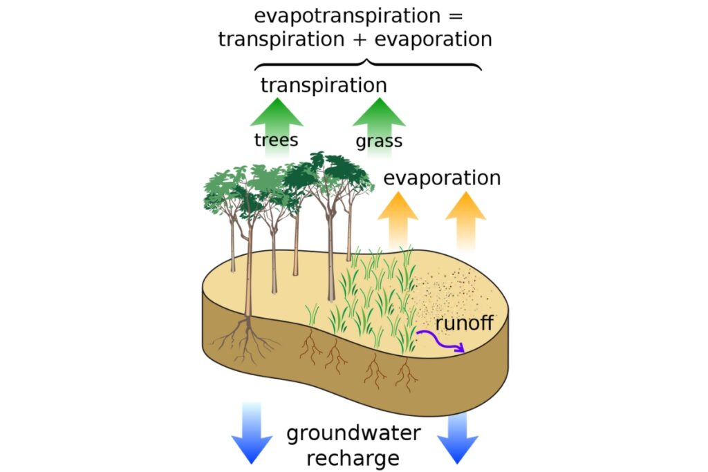
1.6.3. Potential evapotranspiration (P.EVT): It is defined as the amount of evaporation that would occur if a sufficient water source were available.
1.6.4. Difference between Evapotranspiration And Potential Evapotranspiration:
Assuming there is no control over the supply of water, potential evapotranspiration, or P.EV.T, is a measure of the atmosphere’s capacity to remove water from the surface through evaporation and transpiration. The amount of water actually removed from a surface by evaporation and transpiration is known as evapotranspiration.
1.7. Flows:
It is the maximum rate at which soil can absorb rain in a given environment.
1.7.1 Infiltration: The process by which water from the surface of the ground finds its way into the soil.
- Infiltration capacity:
- Vegetation increases infiltration rate.
- The rate increases by 50-100mm/hour.
- Vegetation traps rainfall and slows down the speed at which it arrives at the surface.
1.7.2. The Infiltration capacity decreases with time during precipitation until a constant value [less or more] is obtained.
- Clay Soil- 0-1 mm¯¹/hour¯¹
- Sand Soil- 3-12mm/hour
Infiltration is influenced by many factors:
- Rainfall
- Soil porosity [i.e. pores between soil particles]
- Vegetation cover
- Raindrop size Slope angle
- Pre-existing soil moisture
1.7.3. Overland flow: Also known as Surface run-off is the water flowing over the land’s surface.
Two ways occurrence:
- When the precipitation exceeds the infiltration rate and
- When the soil is saturated i.e. all the pores are filled with water.
- Overland run-off is common in areas with high rainfall but less infiltration. For example in semi-arid areas and in cultivated fields.
- But when the opposite happens the flow is near to the streams and the rivers.
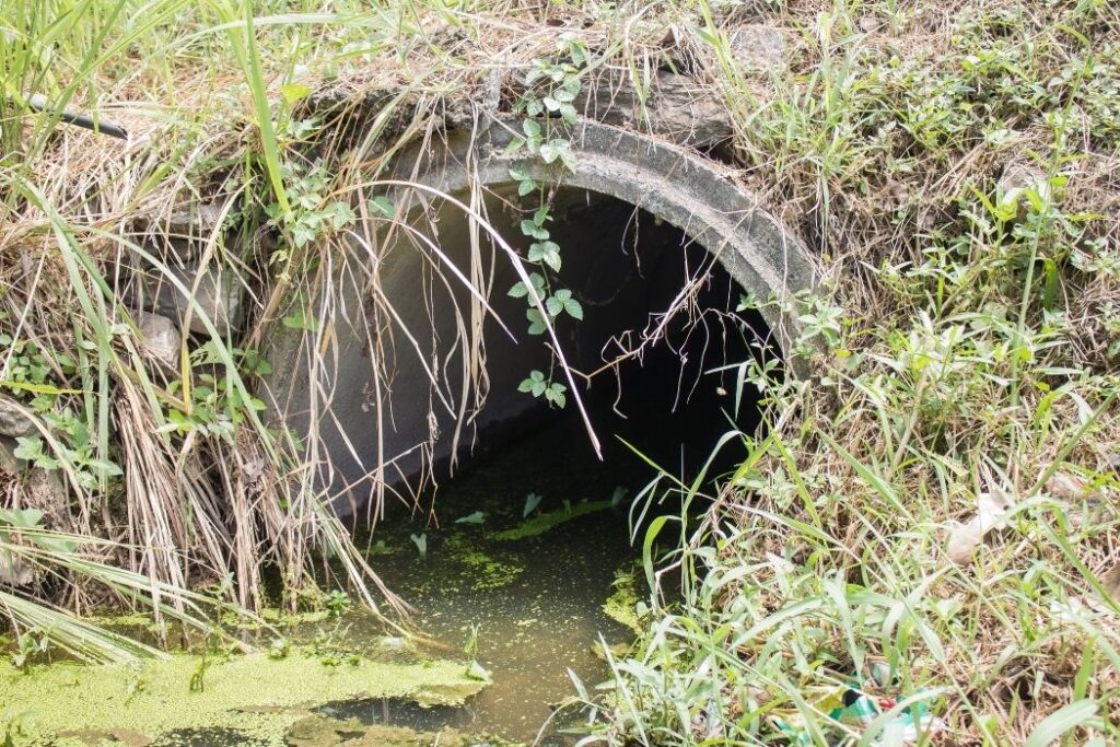
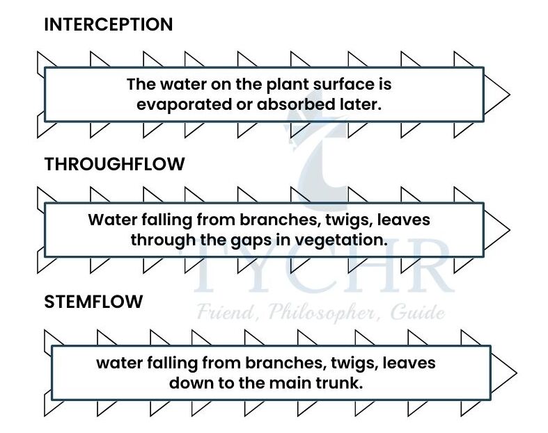
1.7.4. Throughflow: It refers to the irregular horizontal flow of water through the soil layer. Typically, it occurs when the soil is completely submerged in water. This water then streams underground until it arrives at a stream, lake, or sea. Through flow usually moves water at slow rates.
1.7.5. Base flow: It is a non-runoff portion of the stream flow; It is groundwater that enters the channel slowly for a long period of time.
1.8. Stores:
1.8.1 Vegetation: It means the plant life of a region or the plant community. It means all ground cover by plants, and is the main element of the biosphere. Vegetation catches and stores water that is referred to as Interception.
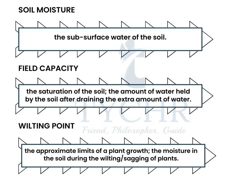
1.8.2. Soil:
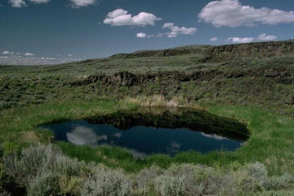
1.8.3. Aquifers: A spring is an underground layer of water-bearing penetrable stone, rock fractures or unconsolidated materials. Groundwater can be extracted using water well. An
aquifer is a body of saturated rock through which water can easily move. Aquifers must be both
permeable and porous and include such rock types as sandstone, conglomerate, fractured limestone
and unconsolidated sand and gravel.
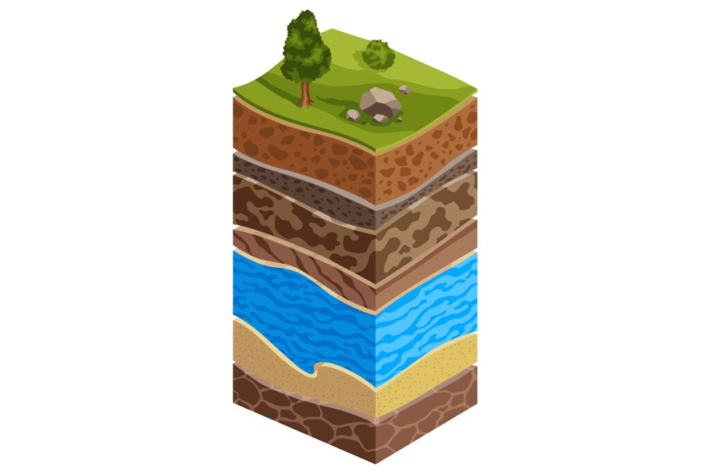
1.8.4. Rock cracks or unconsolidated materials. Using a water well, groundwater can be extracted. An aquifer is a mass of saturated rock through which water easily moves. Examples of aquifers include rocks like sandstone, conglomerate, fractured limestone, and unconsolidated sand and gravel. Aquifers must be both permeable and porous.
1.8.5. Water table: The water table is the limit between the unsaturated zone and the soaked zone underground. Groundwater fills any gaps in the rock and between the sediments below the water table.
1.8.6. Groundwater: Cracks and other openings in rock and sand beds are filled with groundwater.
1.8.7. Recharge: It is the refilling of the ground water which has been dried up or used by humans. Rain is the main source of recharge.
1.8.8. Cryosphere: It refers to all areas of the Earth’s surface where water is solid, such as sea ice, lake ice, river ice, snow cover, glaciers, ice caps, ice sheets, and frozen ground (including permafrost).
19. Stream Flow
1.9.1. Water Flow In Rivers: It is subject to two main forces:
- Gravity: it causes downstream
- Fictional Resistance – with the bed and bank and opposes the flow of the downstream.
- The Volume of Water and the shape of the channel of a river affect the amount of energy a stream has to do its work.
- Turbulence provides an upward direction to the flow and lifts the fine particles.
- It is the product of channel roughness and velocity; as velocity increases and decreases the turbulence increases and reduces respectively.
- Turbulent flow occurs due to:
a) complex channel
b) high velocity
c) cavitation having air bubbles explodes under pressure
1.9.2. Laminar [Laminae] flow is the movement of water in a series of sheets.
- It occurs due under the following conditions:
a) Shallow channel
b) Low velocity
c) Smooth channel
d) Straight channel
1.9.3. Velocity: The speed of the flow of the river/channel is considered here as velocity.
- It varies with some factors like:
a) Volume of water
b) Roughness of bed: the effect of friction creates uneven velocity. The friction near bed and bank is the highest as such the velocity is low.
c) Gradient stream: the velocity is highest in the middle of the stream.
d) Width
e) Depth
f) Shape of the channel.
1.9.4. Channel Shape: Hydraulic radius helps to measure the efficiency of a stream’s shape. The higher the ratio the higher the efficiency is and smaller the fictional loss. The ideal form is semicircular.
The velocity, discharge and flow of the channel are closely related.
The shapes of the channels are determined by the materials forming the river.
a) Solid rocks- slow changes
b) Alluvium deposits – rapid changes
c) Slit and clay- steep, deep and narrow valley is produced
d) Sand and gravel- wide and shallow channel.
1.9.5. Channel Roughness: The relationship between channel roughness and velocity is outlined in the following formula:=[𝑅 3 ∗𝑆2]
𝑛Here, v= velocity, R= hydraulic radius, S= slope and n= roughness.
1.9.6. Mean Annual Discharge:
𝑤𝑎𝑡𝑒𝑟 𝑟𝑢𝑛𝑠 𝑜𝑓𝑓 𝑓𝑜𝑟 𝑒𝑎𝑐ℎ 𝑎𝑟𝑒𝑎 = 𝑚𝑒𝑎𝑛 𝑎𝑛𝑛𝑢𝑎𝑙 𝑑𝑖𝑠𝑐ℎ𝑎𝑟𝑔𝑒 / 𝑑𝑟𝑎𝑖𝑛𝑎𝑔𝑒 𝑏𝑎𝑠𝑖𝑛 𝑎𝑟𝑒𝑎
Some values ranges are:
a)Amazon river- 1000 mm; absolute discharge 230000mᶾ/sec (Highest)
b) Colorado river – 31 mm.
c) Zaire river- 40000mᶾ/sec. (Second)
d) Mississippi river- 18000mᶾ/sec.
1.10. Process Of Erosion, Transportation And Deposition
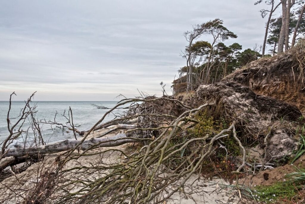
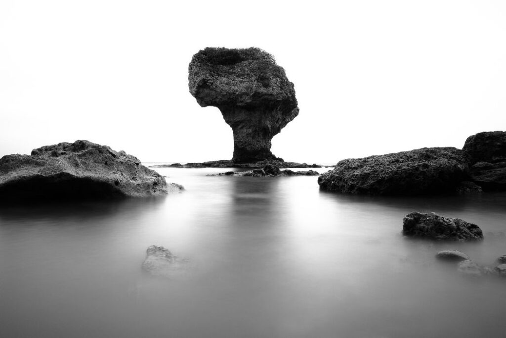
1.10.1. Erosion: Erosion is the action of surface processes that removes soil, rock, or dissolved material from one location on the earth’s crust, and then transports it to another location.
- Attrition: It is the wearing away of the load carried by the river. It creates smaller, rounder particles.
- Hydraulic Action: It is the force of water and air on the sides of rivers and the cracks.
- Corrosion Or Solution: It is the removal of chemical ions, especially calcium.
- Factors Affecting Erosion Are:
a) Load:The amount of erosion is greater the heavier and sharper the load.
b) Velocity: The greater the velocity, the greater the erosion.
c) Gradient: Increased gradient.
d) Geology: Easily eroded- soft, unconsolidated rocks like sand and gravels.
e) pH- rate of solution is high when the water is acidic in nature.
f) Human Impact: Deforestation, dams, bridges etc. increases erosion.
1.10.2. Transportation: The ways for transporting the loads are:
a) Smallest particles are carried as suspended loads. (slits and clay)
b) Larger particles are carried in series of “HOPS” as the salted load. (sand, gavels)
c) Pebbles as tracted loads.
d) Calcareous rocks as dissolved loads.
e) Flotation of materials as leaves, bodies etc.
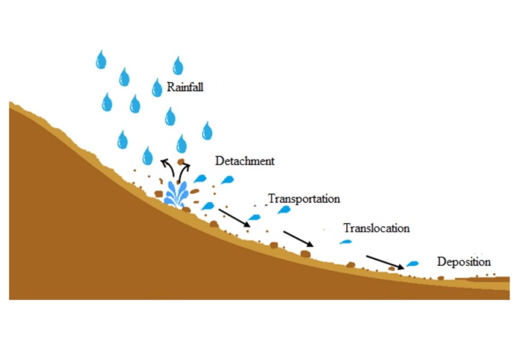
1.10.3. Deposition: The processes by which river-transported material is deposited. When a river loses energy, it experiences deposition. This can occur when a river approaches its mouth, where it meets another body of water, or when it enters a shallow area (such as when it floods and comes into contact with the floodplain).
1.11. The Formation of Typical River Landforms
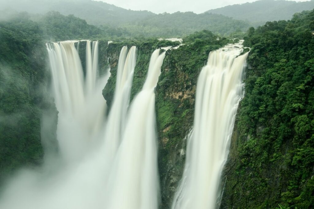
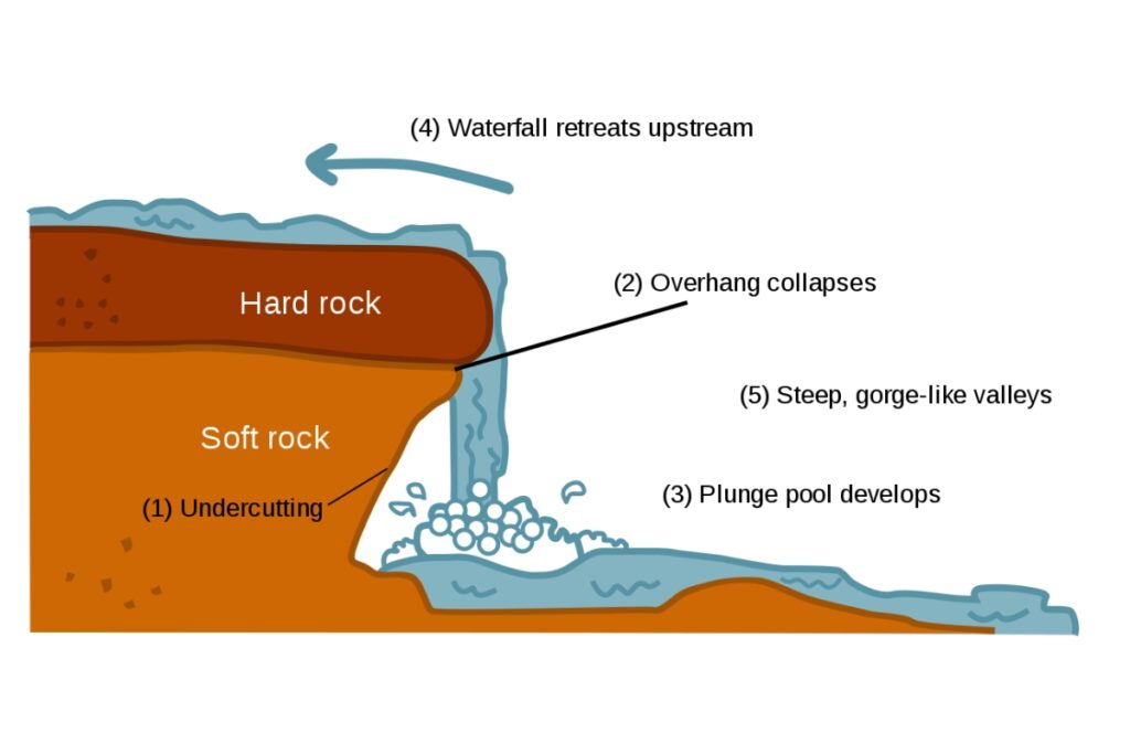
1.11.1. Waterfall: In the course of a stream or river, a fall of water is an area where water flows over a vertical drop or a series of steep drops. Melt water that falls over the edge of an ice shelf or tabular iceberg can also create waterfalls.
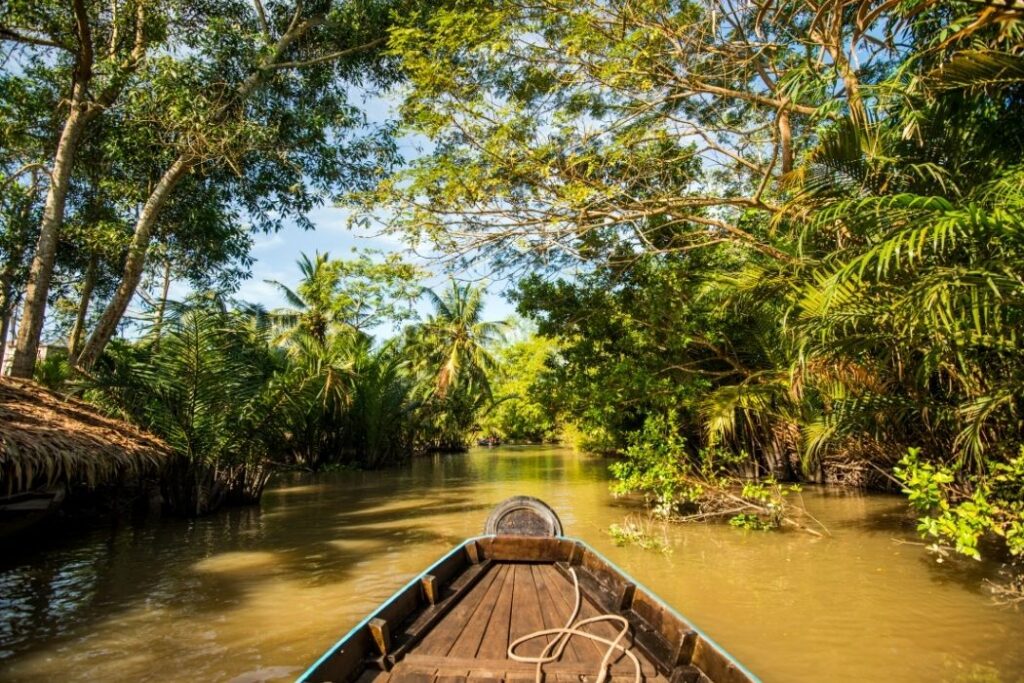
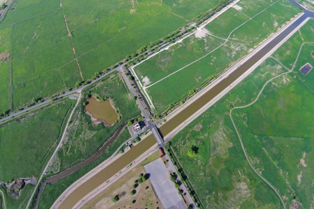
1.11.2. Floodplain: A floodplain or flood plain or flood-plain is an area of land adjacent to a stream or river which stretches from the banks of its channel to the base of the enclosing valley walls, and which experiences flooding during periods of high discharge.
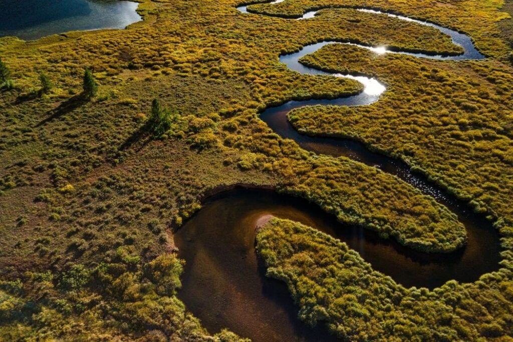
1.11.3. Meanders: A meander is one of a number of regular sinuous bends, loops, turns, or windings that can be found in the channel of a river, stream, or other watercourse. When a river or stream changes its channel within a valley or swings as it moves across its floodplain, it creates it.
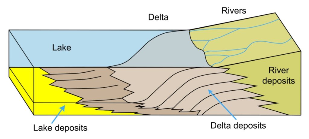
1.11.4. Deltas: A river delta is a landform formed by sediment being carried by a river as it enters slower-moving or stagnant water from its mouth. When a river enters an ocean, sea, estuary, lake, reservoir, or another river that is unable to remove the supplied sediment, this occurs.
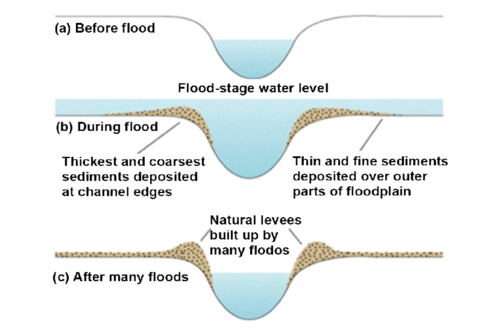
1.11.5. Levees: A levee, dike, dyke, embankment, flood bank or stop bank is an elongated naturally
occurring ridge or artificially constructed fill or wall that regulates water levels. It is usually earthen
and often parallel to the course of a river in its floodplain or along low-lying coastlines